


Submitted by Craig Romano for Northwest Event Organizers
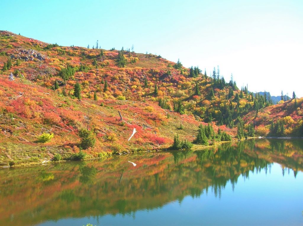
Visit the Black and White Lakes in the fall and discover a surrounding landscape far from black and white. Revel instead in an alpine world of living color. The lakes sit in a basin long burned of its forest cover, now carpeted in by berry bushes, mountain ashes and other shrubs that burst with brilliant hues of red, orange and yellow that come with the autumn equinox. It’s a grunt to reach them, but chances are good you won’t have too much company — unless you count gregarious ground squirrels, docile deer and inquisitive bears.
Hit the Trail
While the Black and White Lakes lie on the trail less traveled, you must first hike some well-trodden paths. Start your journey on the North Fork Skokomish River Trail, which begins on an old road that was decommissioned in the 1970s. Hike through wild country, much like what U.S. Army Second Lieutenant Joseph P. O’Neil saw in the 1880s on his exploratory trips into the Olympic Mountains. But something O’Neil saw that you won’t, were legendary fish runs. Before the North Fork Skokomish’s flow was dammed by Tacoma Power in the 1920s, this river was one of the largest salmon-rearing waterways on the peninsula.
Hike upstream on a wide path and gentle grade crossing several side creeks. Traverse a luxuriant bottomland of big cedars, Douglas firs, and moss-cloaked big-leaf maples. Pass the Staircase -Rapids Loop Trail and consider taking it on the return for a slight variation. After passing Slide Camp, hike across the Beaver Fire of 1985 that was caused by an illegal campfire during a drought and resulted in 1,400 acres of old-growth going up in flames.
The trail then pulls away from the river. At 3.6 miles, reach a junction just before Spike Camp. Now head right on the Flapjack Lakes Trail and slowly climb out of the valley along the old burn line. After a few switchbacks, the trail turns northward on a fairly gentle course. Admire a big cedar grove along the way, then cross Madeline Creek on a sturdy bridge. The creek cascades below through a narrow ravine. Now start heading up steeper and rockier terrain and follow alongside cascading Donahue Creek. At 7.1 miles, you’ll come to a junction. The way to the right is where most folks head—to the Flapjack Lakes and Gladys Divide. You want to head left instead of on the less-traveled trail.
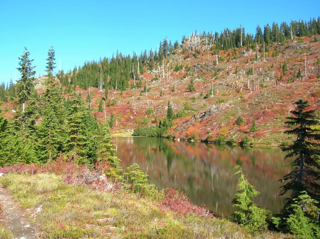
Cross a pair of creeks, and then steeply climb, rounding a ridge to emerge at a 1936 burn site, now blanketed in berry bushes and mountain ash. After passing the log foundation of an old cabin, come to a junction with the Black and White Way Trail at 8.2 miles. The old cabin was once part of a long mining operation here at the lakes. By the mid-1970s it had collapsed leaving only the rotting foundation behind. As you continue to hike into the lake basin, look around for evidence of old mining operations in the form of tailings, pits and cuts.
Now continue straight another 0.2 miles to an unmarked junction. The trail continues for one mile dropping into a forested basin housing Smith Lake. You want to go right and immediately reach the largest of the trio of Black and White Lakes. The lake is small but pretty, with a couple of primitive campsites nearby. The other two lakes are not much more than pothole ponds tucked a little higher in the surrounding basin.
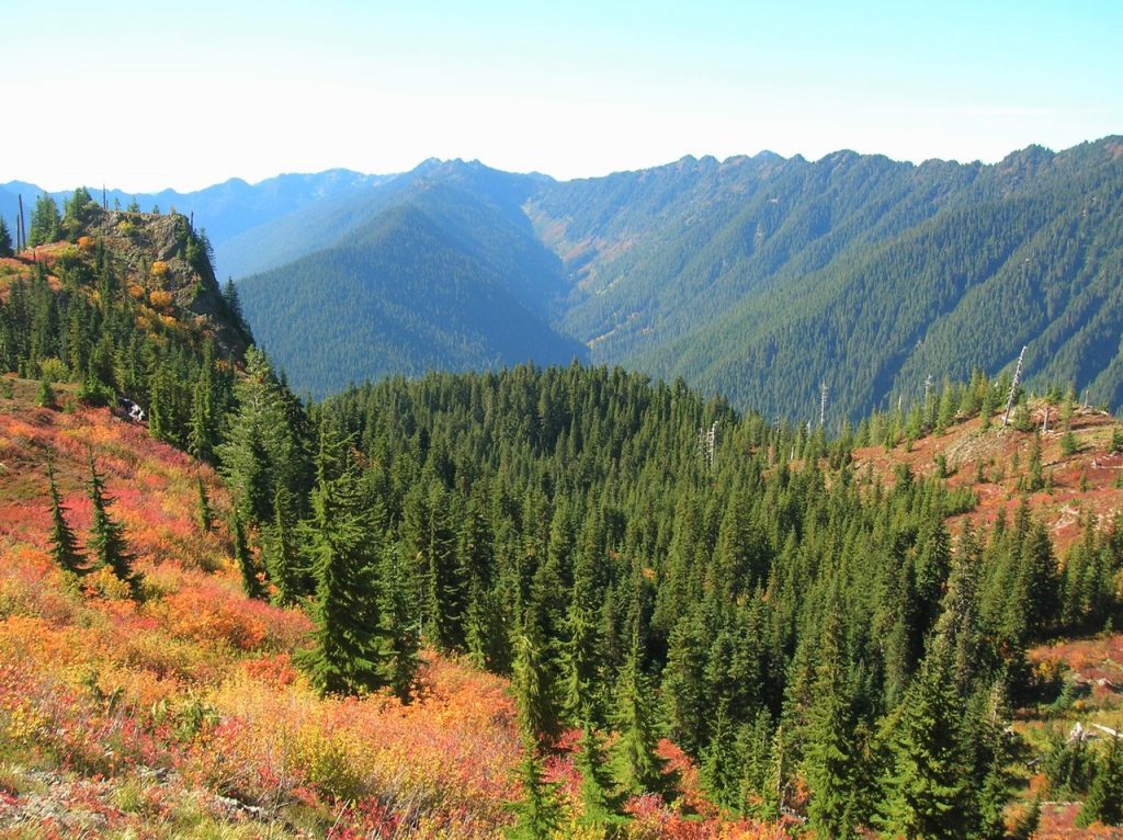
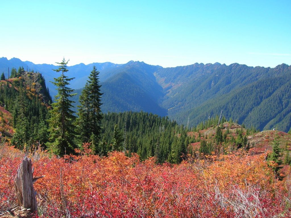
While the lakes aren’t stunning, the views from the open basin are—especially of the surrounding wilderness. Particularly striking are Wonder Mountain and the Three Sisters to the south, Six Ridge to the southwest, and Mount Steel to the northwest. In autumn, this basin transforms into a mosaic of dazzling reds, oranges, and yellows. So where did the name Black and White come from? There are a handful of name origin theories that include the lakes being named after a brand of whisky, the last names of the original prospectors, and a way of describing manganese found at the site.
In any case, the mining history here goes back to claims made in 1907. Copper was the original mineral mined. Getting the copper to market from this remote and rugged location, however, proved to be a challenge. A proposed flume was never built to help get the ore to the North Fork Skokomish Valley from where it was transported to Tacoma via roads. The mine’s claims were sold several times over the years. In the 1940s the mine’s owners dug a 200-foot tunnel. By the 1960s, mining activity had pretty much ceased at the lakes.
When you are ready to leave this beautiful and interesting place, retrace your steps 0.2 miles back to the junction near the old cabin remains. Then return the way you came or consider hiking out via the Black and White Way Trail. It’s a shorter route, but a knee-knocker, dropping more than 2,600 feet in 2.2 incredibly steep miles. While the way is knee-jarring, the tread is smooth and not rocky. The way trail ends at the North Fork Skokomish Trail at the junction with the spur to Big Log Camp. From here it’s 5.4 miles back to the trailhead via the North Fork Skokomish Trail.
Notes
Features: magnificent old-growth forest, wildlife-rich backcountry lake, exceptional autumn foliage, excellent alpine views, historic mining area
Distance: 16.8 miles roundtrip
Elevation Gain: 3,800 feet
High Point: 4,515 feet
Difficulty: moderately difficult
Snow Free: mid- June–Oct
Trailhead Pass Needed: National Park entrance fee. Olympic NP wilderness camping permit required if backpacking.
Notes: Dogs prohibited. No campfires above 3500 feet.
GPS Waypoints: Trailhead: N47 30.968 W123 19.691
Black and White Lakes: N47 34.493 W123 20.556
Land Agency Contact: Olympic National Park, Wilderness Information Center, Port Angeles, 360.565.3100
Recommended Guidebooks: “Backpacking Washington 2nd edition” (Romano, Mountaineers Books)
Trailhead Directions: From Shelton, travel north on US 101 for 15 miles to Hoodsport. Turn left onto State Route 119 and drive 9.3 miles to a T intersection with Forest Road 24. Turn left, continuing on SR 119 which becomes FR 24 for 5.4 miles. Then bear right, coming to the Staircase Ranger Station in 1.2 miles and the trailhead.


