


Walks around Tacoma don’t just have to be ways to get low-impact exercise and bonding time through small talk. They can also build ties to the community and prove educational with just a little effort.
Online options can make a walk along any street in the city more educational, so walkers don’t have to follow some pre-fab tour someone else created if they want to go their own way. There are, thankfully, plenty of those options as well.
The city, unfortunately, doesn’t have a centralized collection of all the historical sites, landmarks and plaques someone might see in their neighborhood. The good thing about that, however, is that there are simply hundreds of them to be “discovered.” What the city does have is a comprehensive database of newspaper clippings and photographs that are indexed by topic as well as address. Do-it-yourself walk planners can simply type in the street name they want to explore into the Tacoma Public Library’s Digital Collection and learn on the go by scrolling through the entries that pop up. Every street has its own story to tell through the images found in the collection. Particularly interesting buildings might also have their own citation in the library’s Building Index.

A popular site for historically minded walkers involves routes around Pierce County. Walkers in the know simply visit the Google map of all the streetcar lines that existed in 1923 and walk the routes. They then “discover” buildings that used to be stations and roadways that once held tracks that they might have knowingly driven over for years. These streetcar tracks ran everywhere and explain some of the odd corners and extra-large intersections that are still in use today. What makes the streetcar map more than just a collection of the routes is the extensive notes about specific stops and notable events in the tracks’ history.
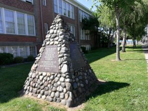
For walkers who aren’t particularly interested in doing data dives before or during their strolls, one stop to finding a walking tour that best fits their route is the City of Tacoma’s Office of Historic Preservation, which has detailed self-guided historic walking routes. Walks cover the Prairie Line Trail, North Slope Historic District, MLK/Historic K Street, Historic South Tacoma Way, Wedge Historic District, Tacoma Sweets, Historic Schools, Tacoma’s Historic Sacred Spaces, Old City Hall Historic District and the Union Station Historic District. More than just maps with routes and bits of information about sites along the walk, some of the tours leverage technology to offer historical photographs and links to information. People can either browse the information as they stroll or delve into a particular site that gains their attention.

Another resource is Downtown On The Go, which has a roster of six walks around the various downtown neighborhoods that highlights the landmark buildings and the history of a particular area. The maps cover the history of the Brewery District, Hilltop, Wright Park, the North Waterfront and South Waterfront, as well as the Museum District. The maps are also available for free in most downtown businesses and government lobbies. The guides provide point-by-point directions as well as descriptions of the must-see sites along each route. Since walking is a healthy way to travel, the brochures also offer a range of how many calories walkers will burn as they venture through the routes.
Another app worthy of a quick download is one for Tacoma’s Japantown that helps downtown strollers connect to the history of the city’s all-but-lost Nihonmachi – or Japantown. The once vibrant neighborhood anchored the city’s downtown during the earliest days of the city only to disappear during the hysteria of World War II.
With smartphones as ubiquitous as water bottles and coffee cups these days, walkers in search of historical knowledge during their strolls can also browse GPSmyCity’s walking tours of Point Defiance Park, the Waterfront, the city’s major landmarks and Tacoma’s Museum District. Walkers can also plot their own routes and add to the collection of tours for future walkers to enjoy.
What you will soon find after some quick web browsing is that there are historical markers, plaques and hidden treasures along every street. That is particularly true if you tap into the hobby of geocaching that mixes walks and hikes with treasure hunting and exploration.
If the self-guided options just aren’t your thing, the city is also home to two guided walking tour companies, Pretty Gritty Tours and Tacoma Ghost Tours.
